Kandla Fm
Type Locality and Naming
SUBSURFACE. Interval 0-2110 m in well Kutch - A. [Original Publication: Zutshi, P.L., Mittal, S.K and Shah, L. (1993) Lithostratigraphy of Indian Petroliferous Basins, Document IV, Kutch Saurashtra Basin, KDMIPE, ONGC Publication, pp 1-50.]
[Figure 1: Stratigraphic chart : Well Kutch Offshore-A (modified after Pandey and Dave, 1998)]
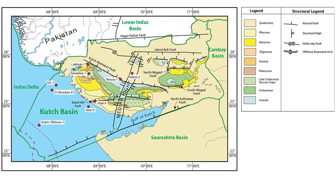
[Fig. Geological and structural map of Kutch, also showing the onshore and offshore wells drilled for oil exploration. (Map by Rasoul Sorkhabi in GeoExpro Dec2014, based on various sources including S.K. Biswas, Current Science, 25May2005)]
Lithology and Thickness
Claystone. Consists of streaky claystone with calcareous concretions and thin bends of poorly fissile silty shale. The formation has shell fragments and pyrite in well Kutch-A. 365 m thickness in well GK-29A-1 and more than 2000 m in Kutch-A and GKH-1 wells.
Relationships and Distribution
Lower contact
In the subsurface the lower boundary to Mitti Nadi Fm is marked by the log break and coincides with seismic marker S-7. Regionally, next older formation is either the Chassara Fm or the local Kankawathi Fm.
Upper contact
Marked by sea bottom in Kutch offshore. Diachronous; and most is not present nearshore.
Regional extent
GeoJSON
Fossils
Miogypsina globulina, S. subelehiscens, G. altispria and Ammonia, Amphistegina, Globotoralia tosaensis tenuitheca
Age
Depositional setting
Inner shelf to middle shelf environment was interpreted in GKH-1 well.
Additional Information

